


SPRINGVILLE - T 1 Voting District, Adams County, Wisconsin
About
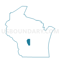
Outline

Summary
| Unique Area Identifier | 692194 |
| Name | SPRINGVILLE - T 1 Voting District |
| County | Adams County |
| State | Wisconsin |
| Area (square miles) | 38.61 |
| Land Area (square miles) | 37.57 |
| Water Area (square miles) | 1.04 |
| % of Land Area | 97.31 |
| % of Water Area | 2.69 |
| Latitude of the Internal Point | 43.78489470 |
| Longtitude of the Internal Point | -89.79724920 |
Maps


Graphs
Select a template below for downloading or customizing gragh for SPRINGVILLE - T 1 Voting District, Adams County, Wisconsin


Neighbors
Neighoring Voting District (by Name) Neighboring Voting District on the Map
- DELL PRAIRIE - T 2 Voting District, Adams County, WI
- EASTON - T 2 Voting District, Adams County, WI
- JACKSON - T 1 Voting District, Adams County, WI
- KILDARE - T 1 Voting District, Juneau County, WI
- MARION - T 1 Voting District, Juneau County, WI
- NEW CHESTER - T 2 Voting District, Adams County, WI
- QUINCY - T 1 Voting District, Adams County, WI
- SPRINGVILLE - T 2 Voting District, Adams County, WI
Top 10 Neighboring County Subdivision (by Population) Neighboring County Subdivision on the Map
- New Chester town, Adams County, WI (2,254)
- Dell Prairie town, Adams County, WI (1,590)
- Springville town, Adams County, WI (1,318)
- Quincy town, Adams County, WI (1,163)
- Easton town, Adams County, WI (1,130)
- Jackson town, Adams County, WI (1,003)
- Kildare town, Juneau County, WI (681)
- Marion town, Juneau County, WI (426)
Top 10 Neighboring Unified School District (by Population) Neighboring Unified School District on the Map
- Adams-Friendship Area School District, WI (14,638)
- Wisconsin Dells School District, WI (12,297)
- Mauston School District, WI (10,238)
Top 10 Neighboring State Legislative District Lower Chamber (by Population) Neighboring State Legislative District Lower Chamber on the Map
- Assembly District 50, WI (59,182)
- Assembly District 42, WI (57,978)
- Assembly District 72, WI (55,757)
Top 10 Neighboring State Legislative District Upper Chamber (by Population) Neighboring State Legislative District Upper Chamber on the Map
- State Senate District 17, WI (172,391)
- State Senate District 14, WI (168,782)
- State Senate District 24, WI (167,083)
Top 10 Neighboring 111th Congressional District (by Population) Neighboring 111th Congressional District on the Map
Top 10 Neighboring Census Tract (by Population) Neighboring Census Tract on the Map
- Census Tract 1004, Juneau County, WI (5,169)
- Census Tract 9505.02, Adams County, WI (4,112)
- Census Tract 1007, Juneau County, WI (4,037)
- Census Tract 9507, Adams County, WI (3,501)
- Census Tract 9505.01, Adams County, WI (1,469)
Top 10 Neighboring 5-Digit ZIP Code Tabulation Area (by Population) Neighboring 5-Digit ZIP Code Tabulation Area on the Map
- 53965, WI (10,398)
- 53948, WI (8,414)
- 53934, WI (4,396)
- 53952, WI (4,377)
- 53910, WI (3,508)
- 53944, WI (2,224)
- 53936, WI (1,610)